
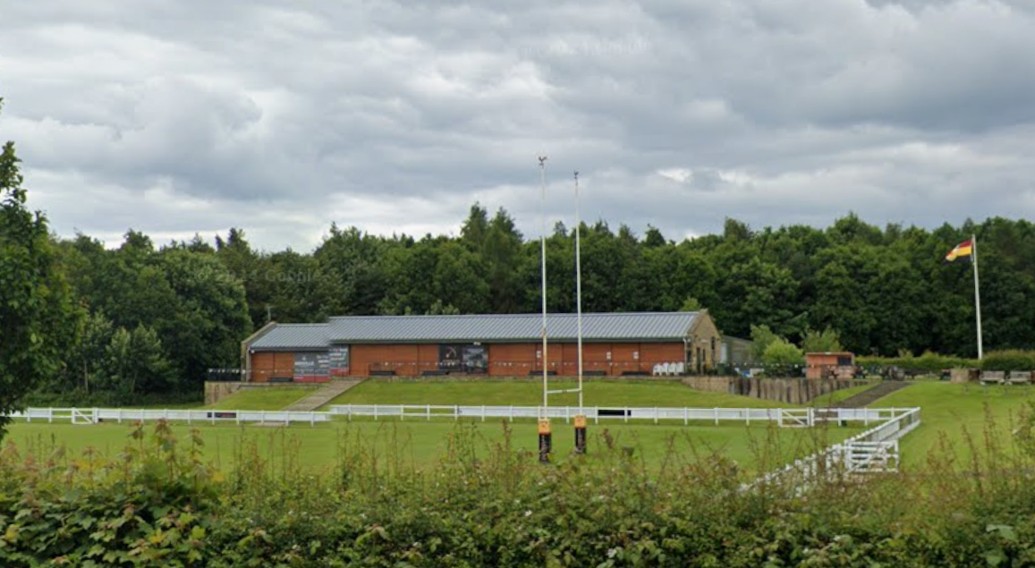
Extension of the existing club house and creation of padel courts at Harrogate Rugby Club.
Site Location
Harrogate Rugby Club is located on Rudding Lane, approximately 7 km south of Harrogate town centre. The wider rugby club site covers approximately 10.9 hectares, with around 4.7 hectares included within the planning application boundary.
The site currently includes:
the existing clubhouse;
rugby pitches;
storage buildings;
car parking and landscaping; and
an existing vehicle entrance from Rudding Lane.
The surrounding area includes a mixture of agricultural land, open space, woodland, homes, businesses and leisure uses. Holme Farm lies immediately to the north, while Rudding Park Estate, including its hotel, spa, golf and leisure facilities, is located to the east on the opposite side of Rudding Lane. Woodland lies to the west and south, with Follifoot Business Park beyond the woodland to the west. A small number of homes are also located to the south-west.
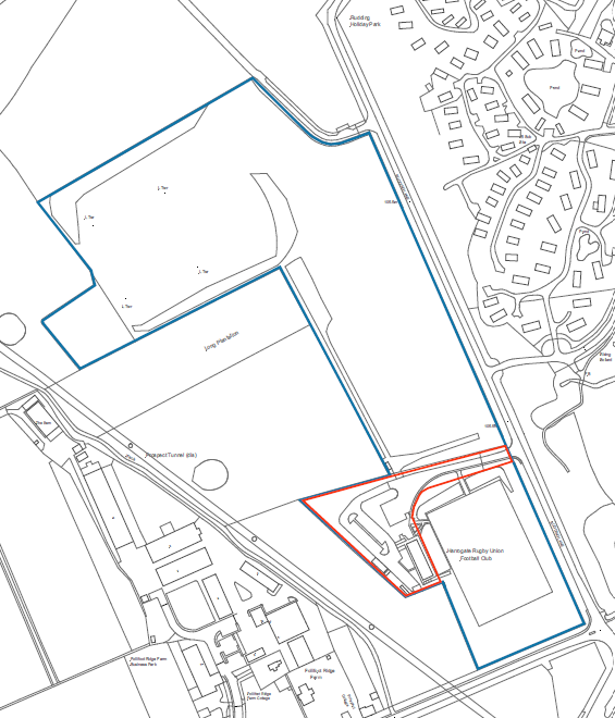
Figure 1: Site Location Plan
Designations
Local Plan
The Harrogate District Local Plan 2014–2035 identifies several planning designations relating to the site and the surrounding area:
The site is located within the Green Belt.
The site lies within the Crimple Valley Special Landscape Area, which is recognised as a locally valued landscape under Policy NE4.
A protected route runs close to the western boundary of the site. Identified under Policy T12, this former railway line between Harrogate and Wetherby is now used as a track.
Rudding Park, located to the east of the site, is designated as a Park or Garden of Historic Interest under Policy HP2.
Further information about how the proposals respond to these designations will be provided as part of the planning application.
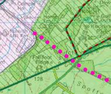
Figure 2: : Harrogate District Local Plan 2014-2035 – Policies Map District and Designated Rural Areas showing Policy T12 Protected Route.
The design evolution process includes an assessment of the constraints and opportunities of the wider area.
Other Planning Considerations:
The site is located within Flood Zone 1 and is therefore at the lowest probability of flooding.
There are no designated heritage assets within the site.
No public rights of way cross or run immediately adjacent to the site.
No Tree Protection Orders (TPO’s) on Site